Select the print to see it larger
Map prints / Africa / Plate 20
Africa
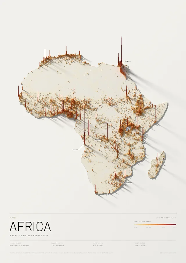
Relief, from the Danakil to Kilimanjaro
Africa as a single relief model, cut to the coast and lit from the north-west. The Atlas, the Tibesti and the Ethiopian Highlands rise out of the Sahara; the Rift runs south past Lake Victoria to Lake Malawi; the Drakensberg rises in the south-east, around Lesotho. Eight summits are named with their heights, from Toubkal to Kilimanjaro.
At this scale each cell of the model averages almost four kilometres of ground, so the summits are lower in the model than on the ground; the labels give their surveyed heights. The projection keeps every country at its true size relative to the others.
Free delivery and installation in Nairobi for framed prints. Delivery across Kenya on request.
- Scale
- 1:22 500 000 at A2, 1:11 250 000 at A0
- Data
- Copernicus DEM GLO-90 (DLR / Airbus, EU and ESA), at about 3.8 km
- Vertical exaggeration
- ×100
- Projection
- Lambert azimuthal equal-area, centred on Africa
- Boundaries
- Natural Earth (public domain)
- Paper
- Matte or satin, your choice